 vesseltracker.com
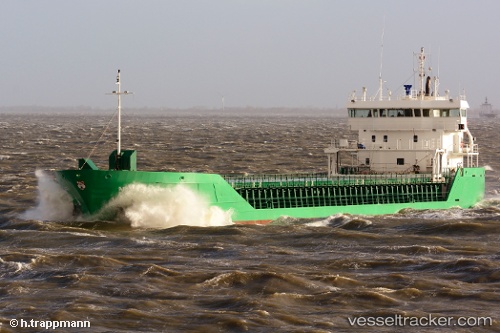
Vessel FAMITA IMO: 9250438, MMSI: 311001499 General Cargo
UTC, 57.91287, 8.02144, course: 273, speed: 12.2
UTC, 57.93183, 7.36978, course: 276, speed: 11.9
2026-03-20 16:23:00 UTC, 58.05077, 6.98671, course: 248, speed: 0
Live Vessel FAMITA Analytics (details, animations, etc.)
Live AIS position: UTC. Near Hausvikstrand), updated 2026-03-20 16:23:00 UTC.Find the position of the vessel FAMITA on the map. The latter are known coordinates and path.
marine traffic ship tracker show on live map
The current position of vessel FAMITA is 58.05077 lat / 6.98671 lng. Updated: 2026-03-20 16:23:00 UTCCurrently sailing under the flag of Bahamas
Details:
Last coordinates of the vessel:
UTC, 57.89023, 8.76901, course: 275, speed: 12.4UTC, 57.91287, 8.02144, course: 273, speed: 12.2
UTC, 57.93183, 7.36978, course: 276, speed: 11.9
2026-03-20 16:23:00 UTC, 58.05077, 6.98671, course: 248, speed: 0