 vesseltracker.com
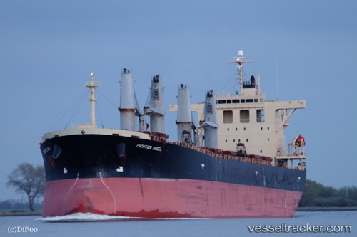
Vessel MONICA D IMO: 9251030, MMSI: 371678000 Bulk Carrier
UTC, 32.35833, 123.28333, course: -1, speed: 10
UTC, 32.64667, 123.23833, course: -1, speed: 10
2026-02-26 07:32:55 UTC, 33.01167, 123.18667, course: -1, speed: 10
Live AIS position:
UTC. 94 nm E of Yangkou Pt),
updated 2026-02-26 07:32:55 UTC.
Find the position of the vessel MONICA D on the map. The latter are known coordinates and path.
marine traffic ship tracker show on live map
The current position of vessel MONICA D is 33.01167 lat / 123.18667 lng. Updated: 2026-02-26 07:32:55 UTCCurrently sailing under the flag of Panama
MONICA D built in 2001 year
Deadweight:
52478 tDetails:
Last coordinates of the vessel:
UTC, 32.12500, 123.31500, course: -1, speed: 10UTC, 32.35833, 123.28333, course: -1, speed: 10
UTC, 32.64667, 123.23833, course: -1, speed: 10
2026-02-26 07:32:55 UTC, 33.01167, 123.18667, course: -1, speed: 10