 vesseltracker.com
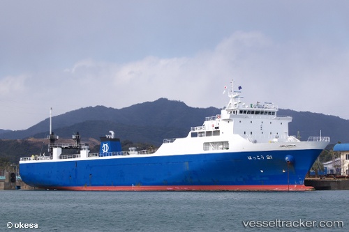
Vessel Hakkou 21 IMO: 9251731, MMSI: 431602082 Ro Ro Cargo Ship
UTC, 33.95996, 130.97888, course: 263, speed: 0
UTC, 33.82023, 131.29153, course: 110, speed: 16
2026-01-30 05:51:46 UTC, 33.56477, 131.80421, course: 145, speed: 15.7
Live AIS position:
UTC. 13 nm NE of Kitsuki),
updated 2026-01-30 05:51:46 UTC.
Find the position of the vessel Hakkou 21 on the map. The latter are known coordinates and path.
marine traffic ship tracker show on live map
The current position of vessel Hakkou 21 is 33.56477 lat / 131.80421 lng. Updated: 2026-01-30 05:51:46 UTCDetails:
Last coordinates of the vessel:
UTC, 33.95998, 130.97887, course: 264, speed: 0UTC, 33.95996, 130.97888, course: 263, speed: 0
UTC, 33.82023, 131.29153, course: 110, speed: 16
2026-01-30 05:51:46 UTC, 33.56477, 131.80421, course: 145, speed: 15.7