 vesseltracker.com
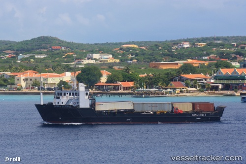
Vessel Dona Luisa I IMO: 9253442, MMSI: 353380000 General Cargo Ship
UTC, 12.48049, -69.99931, course: 296, speed: 0
UTC, 12.48049, -69.99932, course: 296, speed: 0
2026-01-19 13:44:36 UTC, 12.48050, -69.99930, course: 296, speed: 0
Live AIS position:
UTC. Near Barcadera),
updated 2026-01-19 13:44:36 UTC.
Find the position of the vessel Dona Luisa I on the map. The latter are known coordinates and path.
marine traffic ship tracker show on live map
The current position of vessel Dona Luisa I is 12.48050 lat / -69.99930 lng. Updated: 2026-01-19 13:44:36 UTCDetails:
Last coordinates of the vessel:
UTC, 12.48046, -69.99933, course: 297, speed: 0UTC, 12.48049, -69.99931, course: 296, speed: 0
UTC, 12.48049, -69.99932, course: 296, speed: 0
2026-01-19 13:44:36 UTC, 12.48050, -69.99930, course: 296, speed: 0