 vesseltracker.com
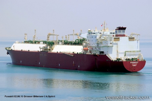
Vessel Fuwairit IMO: 9256200, MMSI: 311605000 Lng Tanker
UTC, 24.19305, 64.54459, course: 20, speed: 12.3
UTC, 24.20751, 64.85440, course: 92, speed: 11.4
2026-01-28 15:29:14 UTC, 24.13680, 65.30001, course: 79, speed: 12.1
Live AIS position:
UTC. 100 nm SW of Kiamari),
updated 2026-01-28 15:29:14 UTC.
Find the position of the vessel Fuwairit on the map. The latter are known coordinates and path.
marine traffic ship tracker show on live map
The current position of vessel Fuwairit is 24.13680 lat / 65.30001 lng. Updated: 2026-01-28 15:29:14 UTCCurrently sailing under the flag of Bahamas
Fuwairit built in 2004 year
Deadweight:
74067 tDetails:
Last coordinates of the vessel:
UTC, 24.13908, 64.90065, course: 273, speed: 12.6UTC, 24.19305, 64.54459, course: 20, speed: 12.3
UTC, 24.20751, 64.85440, course: 92, speed: 11.4
2026-01-28 15:29:14 UTC, 24.13680, 65.30001, course: 79, speed: 12.1