 vesseltracker.com
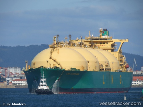
Vessel Lng Adamawa IMO: 9262211, MMSI: 310469000 Lng Tanker
UTC, 30.84500, -11.96500, course: -1, speed: 15
UTC, 31.26833, -11.70833, course: -1, speed: 15
2026-01-26 05:50:03 UTC, 31.66896, -11.46749, course: 25, speed: 15.2
Live AIS position:
UTC. 102 nm W of Essaouira),
updated 2026-01-26 05:50:03 UTC.
Find the position of the vessel Lng Adamawa on the map. The latter are known coordinates and path.
marine traffic ship tracker show on live map
The current position of vessel Lng Adamawa is 31.66896 lat / -11.46749 lng. Updated: 2026-01-26 05:50:03 UTCDetails:
Last coordinates of the vessel:
UTC, 30.45167, -12.18833, course: -1, speed: 14UTC, 30.84500, -11.96500, course: -1, speed: 15
UTC, 31.26833, -11.70833, course: -1, speed: 15
2026-01-26 05:50:03 UTC, 31.66896, -11.46749, course: 25, speed: 15.2