 vesseltracker.com
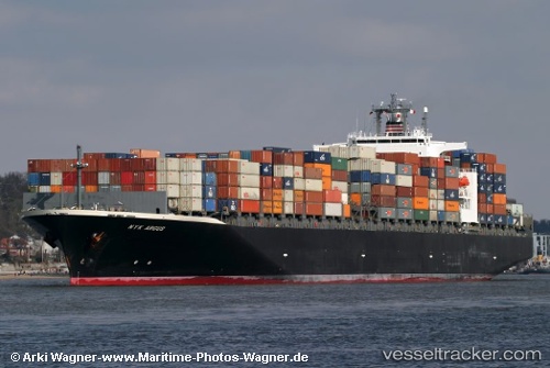
Vessel ARGUS IMO: 9262716, MMSI: 636020476 Container Ship
UTC, 38.09109, -65.62786, course: 69, speed: 12.3
UTC, 38.21350, -65.23639, course: 58, speed: 12.8
2026-02-25 17:41:12 UTC, 38.40841, -64.84340, course: 57, speed: 13
Live AIS position:
UTC. 297 nm SE of NANTUCKET),
updated 2026-02-25 17:41:12 UTC.
Find the position of the vessel ARGUS on the map. The latter are known coordinates and path.
marine traffic ship tracker show on live map
The current position of vessel ARGUS is 38.40841 lat / -64.84340 lng. Updated: 2026-02-25 17:41:12 UTCCurrently sailing under the flag of Liberia
ARGUS built in 2004 year
Deadweight:
81171 tDetails:
Last coordinates of the vessel:
UTC, 37.93762, -66.22691, course: 63, speed: 13.3UTC, 38.09109, -65.62786, course: 69, speed: 12.3
UTC, 38.21350, -65.23639, course: 58, speed: 12.8
2026-02-25 17:41:12 UTC, 38.40841, -64.84340, course: 57, speed: 13