 vesseltracker.com
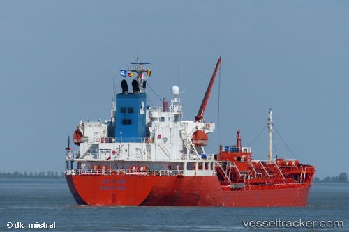
Vessel Stolt Kiri IMO: 9266231, MMSI: 636017828 Chemical Oil Products Tanker
UTC, -0.26153, -38.30221, course: 115, speed: 11.3
UTC, -0.45833, -38.04167, course: -1, speed: 11
2026-02-17 22:04:11 UTC, -0.73333, -37.69167, course: -1, speed: 11
Live AIS position:
UTC. 182 nm NE of Pecém Pt/São Gonçalo do Amarante),
updated 2026-02-17 22:04:11 UTC.
Find the position of the vessel Stolt Kiri on the map. The latter are known coordinates and path.
marine traffic ship tracker show on live map
The current position of vessel Stolt Kiri is -0.73333 lat / -37.69167 lng. Updated: 2026-02-17 22:04:11 UTCDetails:
Last coordinates of the vessel:
UTC, -0.01468, -38.72848, course: 123, speed: 11.8UTC, -0.26153, -38.30221, course: 115, speed: 11.3
UTC, -0.45833, -38.04167, course: -1, speed: 11
2026-02-17 22:04:11 UTC, -0.73333, -37.69167, course: -1, speed: 11