 vesseltracker.com
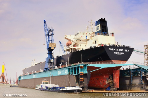
Vessel Chemtrans Sea IMO: 9270490, MMSI: 636090747 Crude Oil Tanker
UTC, 18.15833, -85.37833, course: -1, speed: 2
UTC, 18.15179, -85.30022, course: 96, speed: 2.8
2026-02-27 06:05:56 UTC, 18.14167, -85.20167, course: -1, speed: 2
Live AIS position:
UTC. 84 nm NW of Swan Island),
updated 2026-02-27 06:05:56 UTC.
Find the position of the vessel Chemtrans Sea on the map. The latter are known coordinates and path.
marine traffic ship tracker show on live map
The current position of vessel Chemtrans Sea is 18.14167 lat / -85.20167 lng. Updated: 2026-02-27 06:05:56 UTCCurrently sailing under the flag of Liberia
Chemtrans Sea built in 2004 year
Deadweight:
72365 tDetails:
Last coordinates of the vessel:
UTC, 18.21500, -85.47167, course: -1, speed: 2UTC, 18.15833, -85.37833, course: -1, speed: 2
UTC, 18.15179, -85.30022, course: 96, speed: 2.8
2026-02-27 06:05:56 UTC, 18.14167, -85.20167, course: -1, speed: 2