 vesseltracker.com
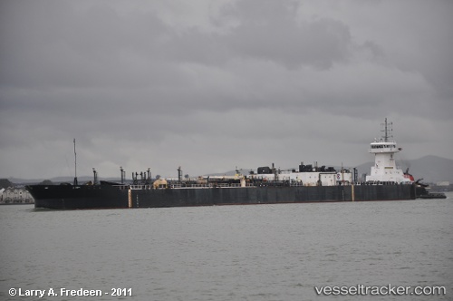
Vessel Coastal Reliance IMO: 9271119, MMSI: 369702000 Pusher Tug
UTC, 32.79504, -79.92652, course: 336, speed: 0
UTC, 32.79505, -79.92652, course: 339, speed: 0
2026-02-13 20:24:54 UTC, 32.79508, -79.92647, course: 341, speed: 0
Live AIS position:
UTC. Near Charleston),
updated 2026-02-13 20:24:54 UTC.
Find the position of the vessel Coastal Reliance on the map. The latter are known coordinates and path.
marine traffic ship tracker show on live map
The current position of vessel Coastal Reliance is 32.79508 lat / -79.92647 lng. Updated: 2026-02-13 20:24:54 UTCCurrently sailing under the flag of USA
Coastal Reliance built in 2002 year
Deadweight:
448 tDetails:
Last coordinates of the vessel:
UTC, 32.79507, -79.92650, course: 340, speed: 0UTC, 32.79504, -79.92652, course: 336, speed: 0
UTC, 32.79505, -79.92652, course: 339, speed: 0
2026-02-13 20:24:54 UTC, 32.79508, -79.92647, course: 341, speed: 0