 vesseltracker.com
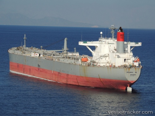
Vessel AFRAMAX RIO IMO: 9273844, MMSI: 636022972 Crude Oil Tanker
UTC, 26.95667, 34.53105, course: 144, speed: 11.3
UTC, 26.67358, 34.74907, course: -1, speed: 10.6
2026-02-26 20:02:22 UTC, 26.36050, 34.99038, course: 141, speed: 10.4
Live AIS position:
UTC. 41 nm E of Al Qusayr),
updated 2026-02-26 20:02:22 UTC.
Find the position of the vessel AFRAMAX RIO on the map. The latter are known coordinates and path.
marine traffic ship tracker show on live map
The current position of vessel AFRAMAX RIO is 26.36050 lat / 34.99038 lng. Updated: 2026-02-26 20:02:22 UTCCurrently sailing under the flag of Liberia
Details:
Last coordinates of the vessel:
UTC, 27.31452, 34.22392, course: -1, speed: 11.1UTC, 26.95667, 34.53105, course: 144, speed: 11.3
UTC, 26.67358, 34.74907, course: -1, speed: 10.6
2026-02-26 20:02:22 UTC, 26.36050, 34.99038, course: 141, speed: 10.4