 vesseltracker.com
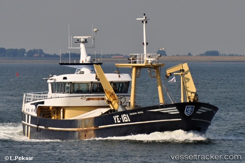
Vessel Ye161 Dingenis Maria IMO: 9280249, MMSI: 244228000 Fishing Vessel
UTC, 51.50051, 4.05398, course: 265, speed: 0
UTC, 51.51306, 4.04541, course: 322, speed: 9.3
2026-02-16 00:01:51 UTC, 51.61281, 3.70633, course: 297, speed: 9.8
Live AIS position:
UTC. Near NEELTJE JANS),
updated 2026-02-16 00:01:51 UTC.
Find the position of the vessel Ye161 Dingenis Maria on the map. The latter are known coordinates and path.
marine traffic ship tracker show on live map
The current position of vessel Ye161 Dingenis Maria is 51.61281 lat / 3.70633 lng. Updated: 2026-02-16 00:01:51 UTCCurrently sailing under the flag of Netherlands
Ye161 Dingenis Maria built in 2002 year
Details:
Last coordinates of the vessel:
UTC, 51.50052, 4.05397, course: 264, speed: 0UTC, 51.50051, 4.05398, course: 265, speed: 0
UTC, 51.51306, 4.04541, course: 322, speed: 9.3
2026-02-16 00:01:51 UTC, 51.61281, 3.70633, course: 297, speed: 9.8