 vesseltracker.com
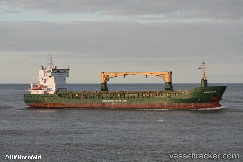
Vessel Betty K Ix IMO: 9280718, MMSI: 354064000 Multi Purpose Carrier
UTC, -10.07833, 136.28333, course: -1, speed: 7
UTC, -10.15470, 136.57097, course: 107, speed: 7.9
2026-02-04 18:19:13 UTC, -10.24500, 136.93668, course: -1, speed: 7
Live AIS position:
UTC. 102 nm N of Elizabeth Bay),
updated 2026-02-04 18:19:13 UTC.
Find the position of the vessel Betty K Ix on the map. The latter are known coordinates and path.
marine traffic ship tracker show on live map
The current position of vessel Betty K Ix is -10.24500 lat / 136.93668 lng. Updated: 2026-02-04 18:19:13 UTCDetails:
Last coordinates of the vessel:
UTC, -10.01667, 136.03667, course: -1, speed: 8UTC, -10.07833, 136.28333, course: -1, speed: 7
UTC, -10.15470, 136.57097, course: 107, speed: 7.9
2026-02-04 18:19:13 UTC, -10.24500, 136.93668, course: -1, speed: 7