 vesseltracker.com
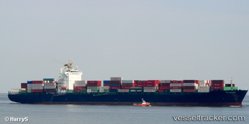
Vessel STAMATIS B IMO: 9280811, MMSI: 636020483 Container Ship
UTC, -34.38820, 26.07275, course: 75, speed: 14.3
UTC, -34.24103, 26.84950, course: 72, speed: 13.2
2026-02-25 09:27:37 UTC, -34.18667, 27.10833, course: -1, speed: 13
Live AIS position:
UTC. 39 nm SE of Kenton-on-Sea),
updated 2026-02-25 09:27:37 UTC.
Find the position of the vessel STAMATIS B on the map. The latter are known coordinates and path.
marine traffic ship tracker show on live map
The current position of vessel STAMATIS B is -34.18667 lat / 27.10833 lng. Updated: 2026-02-25 09:27:37 UTCCurrently sailing under the flag of Liberia
STAMATIS B built in 2004 year
Deadweight:
55497 tDetails:
Last coordinates of the vessel:
UTC, -34.47853, 25.61323, course: 79, speed: 15.9UTC, -34.38820, 26.07275, course: 75, speed: 14.3
UTC, -34.24103, 26.84950, course: 72, speed: 13.2
2026-02-25 09:27:37 UTC, -34.18667, 27.10833, course: -1, speed: 13