 vesseltracker.com
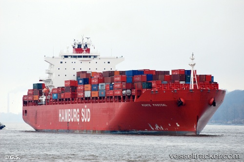
Vessel Monte Pascoal IMO: 9283203, MMSI: 563051300 Container Ship
UTC, 36.21869, -7.76710, course: 103, speed: 14
UTC, 36.16834, -7.50252, course: 104, speed: 12.9
2026-02-22 05:40:29 UTC, 36.06715, -7.01090, course: 105, speed: 10.4
Live AIS position:
UTC. 32 nm W of Gibraltar),
updated 2026-02-22 05:40:29 UTC.
Find the position of the vessel Monte Pascoal on the map. The latter are known coordinates and path.
marine traffic ship tracker show on live map
The current position of vessel Monte Pascoal is 36.06715 lat / -7.01090 lng. Updated: 2026-02-22 05:40:29 UTCDetails:
Last coordinates of the vessel:
UTC, 36.33496, -8.38288, course: 107, speed: 14UTC, 36.21869, -7.76710, course: 103, speed: 14
UTC, 36.16834, -7.50252, course: 104, speed: 12.9
2026-02-22 05:40:29 UTC, 36.06715, -7.01090, course: 105, speed: 10.4