 vesseltracker.com
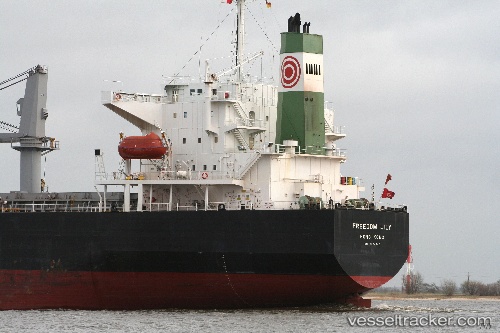
Vessel FREEDOM LINE IMO: 9284245, MMSI: 538010152 Bulk Carrier
2026-02-03 01:16:51 UTC, -85.29028, 50.18156, course: 18, speed: 9.2
Live AIS position:
UTC. Open sea (no nearby ports in database)),
updated 2026-02-03 01:16:51 UTC.
Find the position of the vessel FREEDOM LINE on the map. The latter are known coordinates and path.
marine traffic ship tracker show on live map
The current position of vessel FREEDOM LINE is -85.29028 lat / 50.18156 lng. Updated: 2026-02-03 01:16:51 UTCCurrently sailing under the flag of Marshall Islands
FREEDOM LINE built in 2005 year
Deadweight:
56056 tDetails:
Last coordinates of the vessel:
UTC, -85.29028, 50.18156, course: 18, speed: 9.22026-02-03 01:16:51 UTC, -85.29028, 50.18156, course: 18, speed: 9.2