 vesseltracker.com
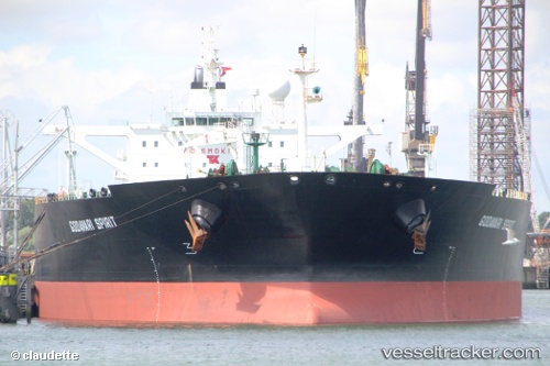
Vessel RIEVERIA I IMO: 9286229, MMSI: 268245201 Crude Oil Tanker
UTC, 1.86333, 104.79667, course: -1, speed: 0
UTC, 1.86379, 104.79782, course: 19, speed: 0
2026-01-20 01:47:16 UTC, 1.86333, 104.79667, course: -1, speed: 0
Live AIS position:
UTC. 50 nm NE of PENGERANG),
updated 2026-01-20 01:47:16 UTC.
Find the position of the vessel RIEVERIA I on the map. The latter are known coordinates and path.
marine traffic ship tracker show on live map
The current position of vessel RIEVERIA I is 1.86333 lat / 104.79667 lng. Updated: 2026-01-20 01:47:16 UTCCurrently sailing under the flag of San Marino
RIEVERIA I built in 2004 year
Deadweight:
159106 tDetails:
Last coordinates of the vessel:
UTC, 1.86333, 104.79667, course: -1, speed: 0UTC, 1.86333, 104.79667, course: -1, speed: 0
UTC, 1.86379, 104.79782, course: 19, speed: 0
2026-01-20 01:47:16 UTC, 1.86333, 104.79667, course: -1, speed: 0