 vesseltracker.com
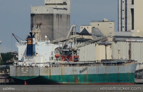
Vessel New Horizon IMO: 9290701, MMSI: 353837000 Bulk Carrier
UTC, 14.90500, 53.78167, course: -1, speed: 11
UTC, 15.13060, 54.08297, course: 49, speed: 11.3
2026-02-15 03:39:15 UTC, 15.31667, 54.31333, course: -1, speed: 11
Live AIS position:
UTC. 99 nm S of Port Raysut),
updated 2026-02-15 03:39:15 UTC.
Find the position of the vessel New Horizon on the map. The latter are known coordinates and path.
marine traffic ship tracker show on live map
The current position of vessel New Horizon is 15.31667 lat / 54.31333 lng. Updated: 2026-02-15 03:39:15 UTCCurrently sailing under the flag of Panama
New Horizon built in 2004 year
Deadweight:
77000 tDetails:
Last coordinates of the vessel:
UTC, 14.90500, 53.78167, course: -1, speed: 11UTC, 14.90500, 53.78167, course: -1, speed: 11
UTC, 15.13060, 54.08297, course: 49, speed: 11.3
2026-02-15 03:39:15 UTC, 15.31667, 54.31333, course: -1, speed: 11