 vesseltracker.com
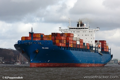
Vessel Talassa IMO: 9290787, MMSI: 255805780 Container Ship
UTC, 34.75451, 121.94039, course: 146, speed: 17.7
UTC, 34.18387, 122.43267, course: 134, speed: 11.4
2026-02-01 03:17:10 UTC, 34.04995, 122.61563, course: 149, speed: 11.3
Live AIS position:
UTC. 101 nm NE of DAFENG),
updated 2026-02-01 03:17:10 UTC.
Find the position of the vessel Talassa on the map. The latter are known coordinates and path.
marine traffic ship tracker show on live map
The current position of vessel Talassa is 34.04995 lat / 122.61563 lng. Updated: 2026-02-01 03:17:10 UTCCurrently sailing under the flag of Portugal
Talassa built in 2005 year
Deadweight:
68228 tDetails:
Last coordinates of the vessel:
UTC, 35.11340, 121.51142, course: 137, speed: 17.7UTC, 34.75451, 121.94039, course: 146, speed: 17.7
UTC, 34.18387, 122.43267, course: 134, speed: 11.4
2026-02-01 03:17:10 UTC, 34.04995, 122.61563, course: 149, speed: 11.3