 vesseltracker.com
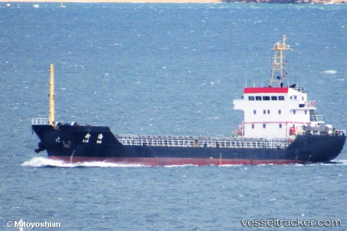
Vessel Chang Yu IMO: 9291925, MMSI: 312151000 Bulk Carrier
UTC, 33.47397, 135.95273, course: 48, speed: 9.1
UTC, 33.76260, 136.31320, course: 36, speed: 9.3
2026-02-14 20:17:37 UTC, 33.98083, 136.59271, course: 52, speed: 9.2
Live AIS position:
UTC. 21 nm SW of HAMAJIMA),
updated 2026-02-14 20:17:37 UTC.
Find the position of the vessel Chang Yu on the map. The latter are known coordinates and path.
marine traffic ship tracker show on live map
The current position of vessel Chang Yu is 33.98083 lat / 136.59271 lng. Updated: 2026-02-14 20:17:37 UTCDetails:
Last coordinates of the vessel:
UTC, 33.37382, 135.64940, course: 78, speed: 12.3UTC, 33.47397, 135.95273, course: 48, speed: 9.1
UTC, 33.76260, 136.31320, course: 36, speed: 9.3
2026-02-14 20:17:37 UTC, 33.98083, 136.59271, course: 52, speed: 9.2