 vesseltracker.com
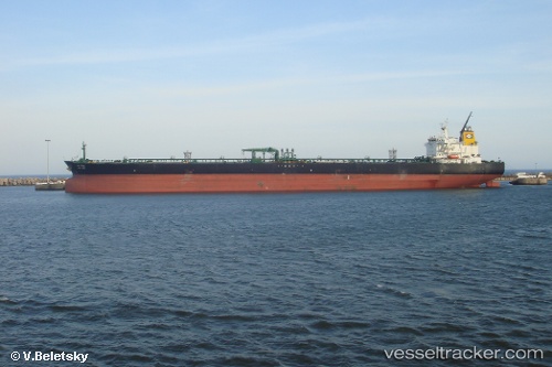
Vessel OCEAN START IMO: 9293507, MMSI: 311001850 Crude Oil Tanker
UTC, 39.36833, 131.18167, course: -1, speed: 2
UTC, 39.31667, 131.09666, course: -1, speed: 5
2026-03-03 09:25:37 UTC, 39.23333, 130.95332, course: -1, speed: 5
Live AIS position:
UTC. 105 nm N of Ulleung-gun),
updated 2026-03-03 09:25:37 UTC.
Find the position of the vessel OCEAN START on the map. The latter are known coordinates and path.
marine traffic ship tracker show on live map
The current position of vessel OCEAN START is 39.23333 lat / 130.95332 lng. Updated: 2026-03-03 09:25:37 UTCCurrently sailing under the flag of Bahamas
Details:
Last coordinates of the vessel:
UTC, 39.42167, 131.26500, course: -1, speed: 2UTC, 39.36833, 131.18167, course: -1, speed: 2
UTC, 39.31667, 131.09666, course: -1, speed: 5
2026-03-03 09:25:37 UTC, 39.23333, 130.95332, course: -1, speed: 5