 vesseltracker.com
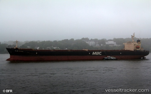
Vessel Captain Mike IMO: 9296846, MMSI: 538006940 Bulk Carrier
UTC, 35.86875, 33.63486, course: -1, speed: 11.1
UTC, 36.06167, 34.33500, course: -1, speed: 11
2026-02-25 15:42:50 UTC, 36.15375, 34.63283, course: 69, speed: 10.7
Live AIS position:
UTC. 37 nm E of TASUCU),
updated 2026-02-25 15:42:50 UTC.
Find the position of the vessel Captain Mike on the map. The latter are known coordinates and path.
marine traffic ship tracker show on live map
The current position of vessel Captain Mike is 36.15375 lat / 34.63283 lng. Updated: 2026-02-25 15:42:50 UTCDetails:
Last coordinates of the vessel:
UTC, 35.70344, 32.61329, course: 80, speed: 11.2UTC, 35.86875, 33.63486, course: -1, speed: 11.1
UTC, 36.06167, 34.33500, course: -1, speed: 11
2026-02-25 15:42:50 UTC, 36.15375, 34.63283, course: 69, speed: 10.7