 vesseltracker.com
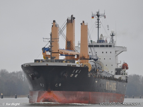
Vessel Iki IMO: 9300881, MMSI: 356641000 Multi Purpose Carrier
UTC, 30.52713, 127.52622, course: 19, speed: 8.3
UTC, 30.81387, 127.68144, course: 11, speed: 6.7
2026-02-07 09:08:53 UTC, 30.92492, 127.72638, course: 10, speed: 7.1
Live AIS position:
UTC. 125 nm SW of Ulju-gun/Ulsan),
updated 2026-02-07 09:08:53 UTC.
Find the position of the vessel Iki on the map. The latter are known coordinates and path.
marine traffic ship tracker show on live map
The current position of vessel Iki is 30.92492 lat / 127.72638 lng. Updated: 2026-02-07 09:08:53 UTCDetails:
Last coordinates of the vessel:
UTC, 30.30320, 127.39487, course: 20, speed: 6.8UTC, 30.52713, 127.52622, course: 19, speed: 8.3
UTC, 30.81387, 127.68144, course: 11, speed: 6.7
2026-02-07 09:08:53 UTC, 30.92492, 127.72638, course: 10, speed: 7.1