 vesseltracker.com
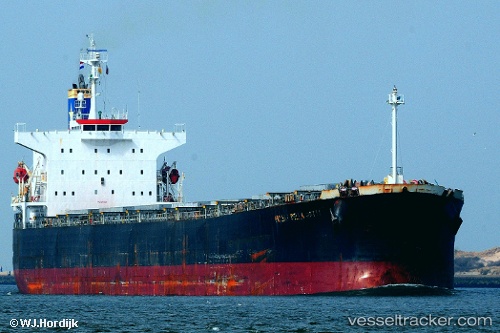
Vessel Navios Harmony IMO: 9301055, MMSI: 352690000 Bulk Carrier
UTC, 4.70333, 138.78168, course: -1, speed: 9
UTC, 4.90667, 138.62833, course: -1, speed: 9
2026-02-08 06:24:44 UTC, 5.29333, 138.34332, course: -1, speed: 9
Live AIS position:
UTC. 209 nm SW of Sorol Atoll),
updated 2026-02-08 06:24:44 UTC.
Find the position of the vessel Navios Harmony on the map. The latter are known coordinates and path.
marine traffic ship tracker show on live map
The current position of vessel Navios Harmony is 5.29333 lat / 138.34332 lng. Updated: 2026-02-08 06:24:44 UTCDetails:
Last coordinates of the vessel:
UTC, 4.54833, 138.90167, course: -1, speed: 9UTC, 4.70333, 138.78168, course: -1, speed: 9
UTC, 4.90667, 138.62833, course: -1, speed: 9
2026-02-08 06:24:44 UTC, 5.29333, 138.34332, course: -1, speed: 9