 vesseltracker.com
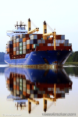
Vessel EAGLE II IMO: 9301122, MMSI: 538010031 Container Ship
UTC, 42.59667, -8.77833, course: -1, speed: 0
UTC, 42.59907, -8.79786, course: 252, speed: 6.3
2026-01-19 18:29:16 UTC, 42.50381, -8.95663, course: 201, speed: 11.5
Live AIS position:
UTC. Near Ribeira (Santa Uxia)),
updated 2026-01-19 18:29:16 UTC.
Find the position of the vessel EAGLE II on the map. The latter are known coordinates and path.
marine traffic ship tracker show on live map
The current position of vessel EAGLE II is 42.50381 lat / -8.95663 lng. Updated: 2026-01-19 18:29:16 UTCCurrently sailing under the flag of Marshall Islands
EAGLE II built in 2006 year
Deadweight:
16986 tDetails:
Last coordinates of the vessel:
UTC, 42.59667, -8.77833, course: -1, speed: 0UTC, 42.59667, -8.77833, course: -1, speed: 0
UTC, 42.59907, -8.79786, course: 252, speed: 6.3
2026-01-19 18:29:16 UTC, 42.50381, -8.95663, course: 201, speed: 11.5