 vesseltracker.com
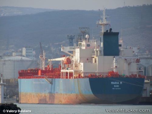
Vessel Maria M IMO: 9301885, MMSI: 247182500 Chemical Oil Products Tanker
UTC, 35.98932, 14.44357, course: 258, speed: 0
UTC, 35.98932, 14.44357, course: 258, speed: 0
2026-02-06 07:28:18 UTC, 35.98932, 14.44357, course: 258, speed: 0
Live AIS position:
UTC. Near BUGIBBA),
updated 2026-02-06 07:28:18 UTC.
Find the position of the vessel Maria M on the map. The latter are known coordinates and path.
marine traffic ship tracker show on live map
The current position of vessel Maria M is 35.98932 lat / 14.44357 lng. Updated: 2026-02-06 07:28:18 UTCCurrently sailing under the flag of Italy
Maria M built in 2006 year
Deadweight:
40057 tDetails:
Last coordinates of the vessel:
UTC, 35.98998, 14.44328, course: 237, speed: 0.4UTC, 35.98932, 14.44357, course: 258, speed: 0
UTC, 35.98932, 14.44357, course: 258, speed: 0
2026-02-06 07:28:18 UTC, 35.98932, 14.44357, course: 258, speed: 0