 vesseltracker.com
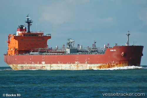
Vessel Mt.ratu Ruwaidah IMO: 9302114, MMSI: 525100736 Chemical Oil Products Tanker
UTC, -5.76173, 113.29915, course: 50, speed: 11.6
UTC, -5.71153, 113.37313, course: 50, speed: 11.7
2026-02-05 08:10:02 UTC, -5.71153, 113.37313, course: 50, speed: 11.7
Live AIS position:
UTC. 42 nm NE of Camar Marine Terminal),
updated 2026-02-05 08:10:02 UTC.
Find the position of the vessel Mt.ratu Ruwaidah on the map. The latter are known coordinates and path.
marine traffic ship tracker show on live map
The current position of vessel Mt.ratu Ruwaidah is -5.71153 lat / 113.37313 lng. Updated: 2026-02-05 08:10:02 UTCCurrently sailing under the flag of Indonesia
Mt.ratu Ruwaidah built in 2005 year
Deadweight:
37025 tDetails:
Last coordinates of the vessel:
UTC, -6.02376, 112.94980, course: 45, speed: 11.9UTC, -5.76173, 113.29915, course: 50, speed: 11.6
UTC, -5.71153, 113.37313, course: 50, speed: 11.7
2026-02-05 08:10:02 UTC, -5.71153, 113.37313, course: 50, speed: 11.7