 vesseltracker.com
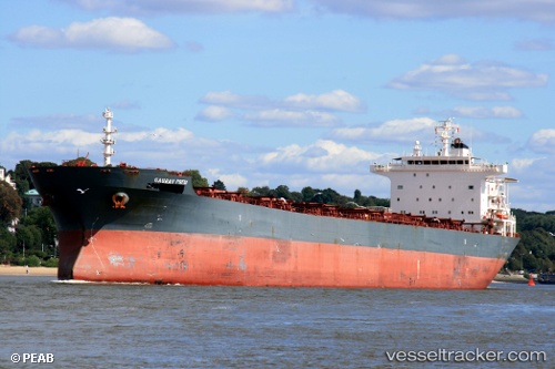
Vessel Xin Ang IMO: 9305142, MMSI: 414352000 Bulk Carrier
UTC, 9.57753, 109.88514, course: -1, speed: 10.7
UTC, 9.20611, 109.79461, course: 196, speed: 10
2026-02-27 05:39:55 UTC, 8.90068, 109.71390, course: 196, speed: 10.8
Live AIS position:
UTC. 67 nm NE of Dai Hung (Tandem Load)),
updated 2026-02-27 05:39:55 UTC.
Find the position of the vessel Xin Ang on the map. The latter are known coordinates and path.
marine traffic ship tracker show on live map
The current position of vessel Xin Ang is 8.90068 lat / 109.71390 lng. Updated: 2026-02-27 05:39:55 UTCCurrently sailing under the flag of China
Xin Ang built in 2005 year
Deadweight:
73901 tDetails:
Last coordinates of the vessel:
UTC, 9.95419, 109.98385, course: 198, speed: 10.6UTC, 9.57753, 109.88514, course: -1, speed: 10.7
UTC, 9.20611, 109.79461, course: 196, speed: 10
2026-02-27 05:39:55 UTC, 8.90068, 109.71390, course: 196, speed: 10.8