 vesseltracker.com
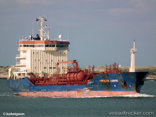
Vessel Caribe Angela IMO: 9305403, MMSI: 636017775 Chemical Tanker
UTC, 25.77107, 55.49139, course: 40, speed: 9.8
UTC, 25.92892, 55.62856, course: 40, speed: 10.1
2026-02-09 10:32:14 UTC, 26.30712, 56.02797, course: 55, speed: 10.7
Live AIS position:
UTC. 13 nm NW of KHASAB),
updated 2026-02-09 10:32:14 UTC.
Find the position of the vessel Caribe Angela on the map. The latter are known coordinates and path.
marine traffic ship tracker show on live map
The current position of vessel Caribe Angela is 26.30712 lat / 56.02797 lng. Updated: 2026-02-09 10:32:14 UTCCurrently sailing under the flag of Liberia
Caribe Angela built in 2004 year
Deadweight:
10052 tDetails:
Last coordinates of the vessel:
UTC, 25.50223, 55.47192, course: 320, speed: 8.5UTC, 25.77107, 55.49139, course: 40, speed: 9.8
UTC, 25.92892, 55.62856, course: 40, speed: 10.1
2026-02-09 10:32:14 UTC, 26.30712, 56.02797, course: 55, speed: 10.7