 vesseltracker.com
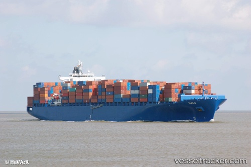
Vessel Maersk Puelo IMO: 9306172, MMSI: 353117000 Container Ship
UTC, 36.25952, 15.31039, course: 288, speed: 10.7
UTC, 36.33304, 15.01660, course: 305, speed: 10.1
2026-02-21 14:24:07 UTC, 36.46369, 14.50898, course: 285, speed: 9.9
Live AIS position:
UTC. 19 nm S of Marina di Ragusa),
updated 2026-02-21 14:24:07 UTC.
Find the position of the vessel Maersk Puelo on the map. The latter are known coordinates and path.
marine traffic ship tracker show on live map
The current position of vessel Maersk Puelo is 36.46369 lat / 14.50898 lng. Updated: 2026-02-21 14:24:07 UTCCurrently sailing under the flag of Panama
Maersk Puelo built in 2006 year
Deadweight:
81250 tDetails:
Last coordinates of the vessel:
UTC, 36.17622, 15.71877, course: 287, speed: 10.2UTC, 36.25952, 15.31039, course: 288, speed: 10.7
UTC, 36.33304, 15.01660, course: 305, speed: 10.1
2026-02-21 14:24:07 UTC, 36.46369, 14.50898, course: 285, speed: 9.9