 vesseltracker.com
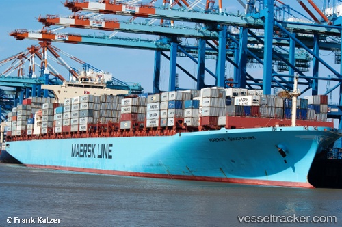
Vessel Maersk Singapore IMO: 9308649, MMSI: 563000600 Container Ship
UTC, 21.44500, -49.89667, course: -1, speed: 15
UTC, 20.95540, -49.28542, course: 128, speed: 15.5
2026-02-21 05:26:38 UTC, 20.81900, -49.12580, course: 128, speed: 15.4
Live AIS position:
UTC. 201 nm W of Upper Northfield),
updated 2026-02-21 05:26:38 UTC.
Find the position of the vessel Maersk Singapore on the map. The latter are known coordinates and path.
marine traffic ship tracker show on live map
The current position of vessel Maersk Singapore is 20.81900 lat / -49.12580 lng. Updated: 2026-02-21 05:26:38 UTCDetails:
Last coordinates of the vessel:
UTC, 21.66454, -50.18598, course: 127, speed: 14.9UTC, 21.44500, -49.89667, course: -1, speed: 15
UTC, 20.95540, -49.28542, course: 128, speed: 15.5
2026-02-21 05:26:38 UTC, 20.81900, -49.12580, course: 128, speed: 15.4