 vesseltracker.com
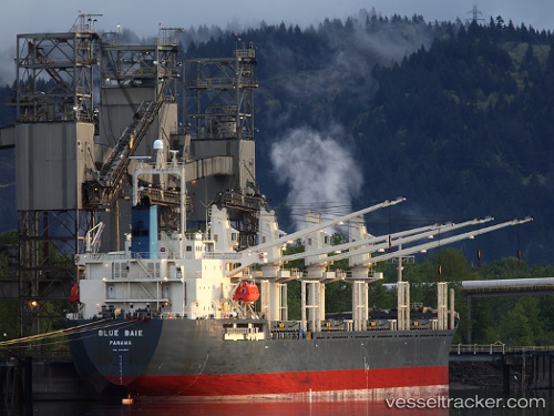
Vessel Blue Baie IMO: 9309617, MMSI: 371716000 General Cargo Ship
UTC, 35.53860, -6.41322, course: 215, speed: 12
UTC, 35.29720, -6.61178, course: 217, speed: 12.1
2026-02-09 19:12:29 UTC, 34.98888, -6.86040, course: 215, speed: 12
Live AIS position:
UTC. 29 nm W of Moulay Bou Selham),
updated 2026-02-09 19:12:29 UTC.
Find the position of the vessel Blue Baie on the map. The latter are known coordinates and path.
marine traffic ship tracker show on live map
The current position of vessel Blue Baie is 34.98888 lat / -6.86040 lng. Updated: 2026-02-09 19:12:29 UTCCurrently sailing under the flag of Panama
Blue Baie built in 2006 year
Deadweight:
31734 tDetails:
Last coordinates of the vessel:
UTC, 35.83945, -6.12007, course: 237, speed: 11.7UTC, 35.53860, -6.41322, course: 215, speed: 12
UTC, 35.29720, -6.61178, course: 217, speed: 12.1
2026-02-09 19:12:29 UTC, 34.98888, -6.86040, course: 215, speed: 12