 vesseltracker.com
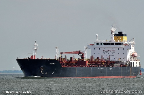
Vessel '247450100' IMO: 9313436, MMSI: 247450100
UTC, 49.50046, -6.43214, course: 63, speed: 12.3
UTC, 49.89286, -5.92699, course: 19, speed: 11.4
2026-01-28 03:31:34 UTC, 50.05683, -5.89367, course: 359, speed: 10.8
Live AIS position:
UTC. Near Land's End),
updated 2026-01-28 03:31:34 UTC.
Find the position of the vessel '247450100' on the map. The latter are known coordinates and path.
marine traffic ship tracker show on live map
The current position of vessel '247450100' is 50.05683 lat / -5.89367 lng. Updated: 2026-01-28 03:31:34 UTCDetails:
Last coordinates of the vessel:
UTC, 49.35667, -6.89667, course: -1, speed: 12UTC, 49.50046, -6.43214, course: 63, speed: 12.3
UTC, 49.89286, -5.92699, course: 19, speed: 11.4
2026-01-28 03:31:34 UTC, 50.05683, -5.89367, course: 359, speed: 10.8