 vesseltracker.com
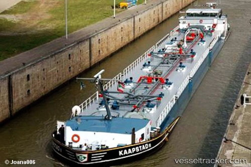
Vessel Kaapstad IMO: 9313606, MMSI: 205370590 Other Tanker
UTC, 51.93238, 4.15691, course: 298, speed: 0
UTC, 51.93238, 4.15690, course: 298, speed: 0
2026-02-01 15:33:40 UTC, 51.95032, 4.09136, course: 315, speed: 0
Live AIS position:
UTC. Near MAASVLAKTE - ROTTERDAM),
updated 2026-02-01 15:33:40 UTC.
Find the position of the vessel Kaapstad on the map. The latter are known coordinates and path.
marine traffic ship tracker show on live map
The current position of vessel Kaapstad is 51.95032 lat / 4.09136 lng. Updated: 2026-02-01 15:33:40 UTCCurrently sailing under the flag of Belgium
Details:
Last coordinates of the vessel:
UTC, 51.93238, 4.15689, course: 298, speed: 0UTC, 51.93238, 4.15691, course: 298, speed: 0
UTC, 51.93238, 4.15690, course: 298, speed: 0
2026-02-01 15:33:40 UTC, 51.95032, 4.09136, course: 315, speed: 0