 vesseltracker.com
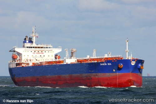
Vessel CHEMTRANS NOVA IMO: 9316232, MMSI: 636092969 Crude Oil Tanker
UTC, -46.42654, 105.20477, course: 32, speed: 15.7
UTC, -46.42654, 105.20477, course: 32, speed: 15.7
UTC, -46.42654, 105.20477, course: 32, speed: 15.7
2026-01-27 09:56:32 UTC, -46.42654, 105.20477, course: 32, speed: 15.7
Live AIS position:
UTC. Open sea (no nearby ports in database)),
updated 2026-01-27 09:56:32 UTC.
Find the position of the vessel CHEMTRANS NOVA on the map. The latter are known coordinates and path.
marine traffic ship tracker show on live map
The current position of vessel CHEMTRANS NOVA is -46.42654 lat / 105.20477 lng. Updated: 2026-01-27 09:56:32 UTCCurrently sailing under the flag of Liberia
CHEMTRANS NOVA built in 2006 year
Deadweight:
73870 tDetails:
Last coordinates of the vessel:
UTC, -46.42654, 105.20477, course: 32, speed: 15.7UTC, -46.42654, 105.20477, course: 32, speed: 15.7
UTC, -46.42654, 105.20477, course: 32, speed: 15.7
UTC, -46.42654, 105.20477, course: 32, speed: 15.7
2026-01-27 09:56:32 UTC, -46.42654, 105.20477, course: 32, speed: 15.7