 vesseltracker.com
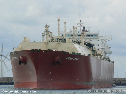
Vessel Milaha Qatar IMO: 9321732, MMSI: 229129000 Lng Tanker
UTC, 13.45167, 113.59667, course: -1, speed: 14
UTC, 13.82947, 113.93130, course: 39, speed: 13.2
2026-02-24 07:39:43 UTC, 14.10500, 114.17167, course: -1, speed: 13
Live AIS position:
UTC. 254 nm E of Tan Cang Qui Nhon),
updated 2026-02-24 07:39:43 UTC.
Find the position of the vessel Milaha Qatar on the map. The latter are known coordinates and path.
marine traffic ship tracker show on live map
The current position of vessel Milaha Qatar is 14.10500 lat / 114.17167 lng. Updated: 2026-02-24 07:39:43 UTCCurrently sailing under the flag of Malta
Milaha Qatar built in 2006 year
Deadweight:
77803 tDetails:
Last coordinates of the vessel:
UTC, 13.08333, 113.37667, course: -1, speed: 14UTC, 13.45167, 113.59667, course: -1, speed: 14
UTC, 13.82947, 113.93130, course: 39, speed: 13.2
2026-02-24 07:39:43 UTC, 14.10500, 114.17167, course: -1, speed: 13