 vesseltracker.com
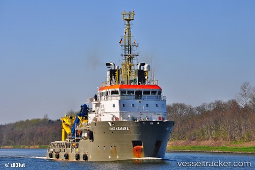
Vessel Kamara IMO: 9322607, MMSI: 215088000 Offshore Tug Supply Ship
UTC, 54.61232, 12.53161, course: 34, speed: 0.1
UTC, 54.61138, 12.53273, course: 36, speed: 0.1
2026-02-13 18:28:55 UTC, 54.61081, 12.53161, course: 35, speed: 0.1
Live AIS position:
UTC. 12 nm N of Wieck auf dem Dass),
updated 2026-02-13 18:28:55 UTC.
Find the position of the vessel Kamara on the map. The latter are known coordinates and path.
marine traffic ship tracker show on live map
The current position of vessel Kamara is 54.61081 lat / 12.53161 lng. Updated: 2026-02-13 18:28:55 UTCDetails:
Last coordinates of the vessel:
UTC, 54.61264, 12.53186, course: 35, speed: 0UTC, 54.61232, 12.53161, course: 34, speed: 0.1
UTC, 54.61138, 12.53273, course: 36, speed: 0.1
2026-02-13 18:28:55 UTC, 54.61081, 12.53161, course: 35, speed: 0.1