 vesseltracker.com
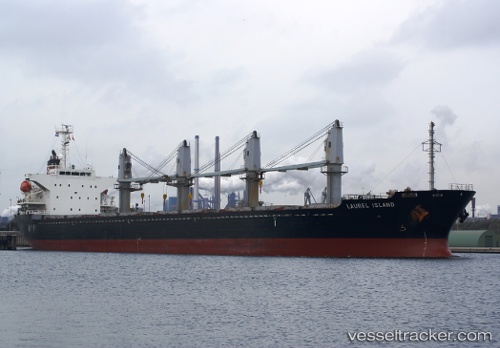
Vessel Med Island IMO: 9322748, MMSI: 256155000 Bulk Carrier
UTC, 36.80475, 10.44272, course: -1, speed: 0
UTC, 36.80475, 10.44272, course: -1, speed: 0
2026-03-03 19:00:03 UTC, 36.80475, 10.44272, course: -1, speed: 0
Live Vessel Med Island Analytics (details, animations, etc.)
Live AIS position: UTC. Near Le Kram), updated 2026-03-03 19:00:03 UTC.Find the position of the vessel Med Island on the map. The latter are known coordinates and path.
marine traffic ship tracker show on live map
The current position of vessel Med Island is 36.80475 lat / 10.44272 lng. Updated: 2026-03-03 19:00:03 UTCCurrently sailing under the flag of Malta
Med Island built in 2005 year
Deadweight:
28556 tDetails:
Last coordinates of the vessel:
UTC, 36.80477, 10.44273, course: -1, speed: 0.1UTC, 36.80475, 10.44272, course: -1, speed: 0
UTC, 36.80475, 10.44272, course: -1, speed: 0
2026-03-03 19:00:03 UTC, 36.80475, 10.44272, course: -1, speed: 0