 vesseltracker.com
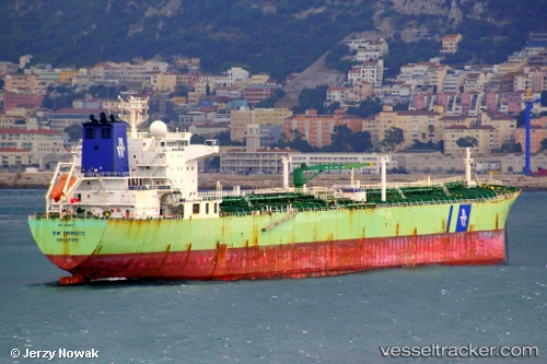
Vessel MARALTA IMO: 9324320, MMSI: 305255000 Oil Products Tanker
UTC, 12.36312, 43.98167, course: 296, speed: 14
UTC, 12.45185, 43.76260, course: 292, speed: 13.5
2026-03-02 13:26:20 UTC, 12.36070, 43.83832, course: 115, speed: 11.8
Live AIS position:
UTC. 30 nm SE of Perim Island),
updated 2026-03-02 13:26:20 UTC.
Find the position of the vessel MARALTA on the map. The latter are known coordinates and path.
marine traffic ship tracker show on live map
The current position of vessel MARALTA is 12.36070 lat / 43.83832 lng. Updated: 2026-03-02 13:26:20 UTCCurrently sailing under the flag of Antigua and Barbuda
Details:
Last coordinates of the vessel:
UTC, 12.16128, 44.47997, course: 293, speed: 14.3UTC, 12.36312, 43.98167, course: 296, speed: 14
UTC, 12.45185, 43.76260, course: 292, speed: 13.5
2026-03-02 13:26:20 UTC, 12.36070, 43.83832, course: 115, speed: 11.8