 vesseltracker.com
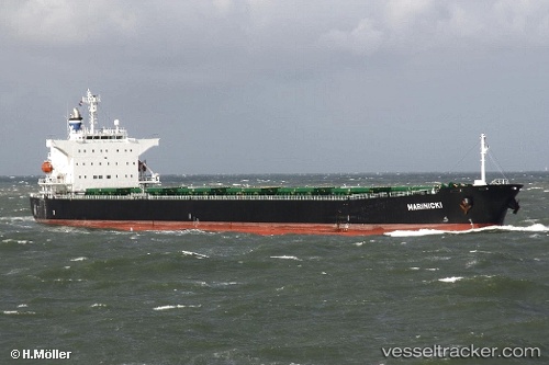
Vessel Marinicki IMO: 9325063, MMSI: 249650000 Bulk Carrier
UTC, -3.93125, 115.78210, course: 23, speed: 0
UTC, -3.93123, 115.78255, course: 9, speed: 0
2026-02-17 17:54:49 UTC, -3.93042, 115.78418, course: 301, speed: 0
Live AIS position:
UTC. 15 nm SE of Bunati),
updated 2026-02-17 17:54:49 UTC.
Find the position of the vessel Marinicki on the map. The latter are known coordinates and path.
marine traffic ship tracker show on live map
The current position of vessel Marinicki is -3.93042 lat / 115.78418 lng. Updated: 2026-02-17 17:54:49 UTCDetails:
Last coordinates of the vessel:
UTC, -3.93032, 115.78100, course: 69, speed: 0UTC, -3.93125, 115.78210, course: 23, speed: 0
UTC, -3.93123, 115.78255, course: 9, speed: 0
2026-02-17 17:54:49 UTC, -3.93042, 115.78418, course: 301, speed: 0