 vesseltracker.com
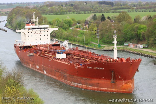
Vessel BAM SANDY IMO: 9326914, MMSI: 314104000 Oil/Chemical Tanker
UTC, 11.55166, 74.16167, course: -1, speed: 13
UTC, 11.96500, 73.93333, course: -1, speed: 13
2026-02-27 13:18:50 UTC, 12.43423, 73.63196, course: 330, speed: 13.8
Live AIS position:
UTC. 72 nm W of New Mangalore),
updated 2026-02-27 13:18:50 UTC.
Find the position of the vessel BAM SANDY on the map. The latter are known coordinates and path.
marine traffic ship tracker show on live map
The current position of vessel BAM SANDY is 12.43423 lat / 73.63196 lng. Updated: 2026-02-27 13:18:50 UTCCurrently sailing under the flag of Barbados
Details:
Last coordinates of the vessel:
UTC, 11.23500, 74.20500, course: -1, speed: 12UTC, 11.55166, 74.16167, course: -1, speed: 13
UTC, 11.96500, 73.93333, course: -1, speed: 13
2026-02-27 13:18:50 UTC, 12.43423, 73.63196, course: 330, speed: 13.8