 vesseltracker.com
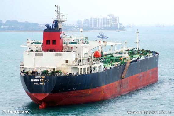
Vessel FAIR WINDS IMO: 9327009, MMSI: 538009517 Crude Oil Tanker
UTC, 25.19375, 56.55509, course: 232, speed: 0
UTC, 25.19075, 56.55447, course: -1, speed: 0
2026-02-26 06:14:49 UTC, 25.19046, 56.55369, course: 3, speed: 0.1
Live AIS position:
UTC. Near Fujairah),
updated 2026-02-26 06:14:49 UTC.
Find the position of the vessel FAIR WINDS on the map. The latter are known coordinates and path.
marine traffic ship tracker show on live map
The current position of vessel FAIR WINDS is 25.19046 lat / 56.55369 lng. Updated: 2026-02-26 06:14:49 UTCCurrently sailing under the flag of Marshall Islands
FAIR WINDS built in 2007 year
Deadweight:
73976 tDetails:
Last coordinates of the vessel:
UTC, 25.19431, 56.55370, course: 190, speed: 0UTC, 25.19375, 56.55509, course: 232, speed: 0
UTC, 25.19075, 56.55447, course: -1, speed: 0
2026-02-26 06:14:49 UTC, 25.19046, 56.55369, course: 3, speed: 0.1