 vesseltracker.com
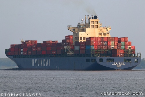
Vessel Hyundai Forward IMO: 9330707, MMSI: 538007482 Container Ship
UTC, 53.96803, 171.93205, course: 244, speed: 14.1
UTC, 53.68127, 171.01825, course: 239, speed: 14.4
2026-03-02 00:07:35 UTC, 53.42412, 170.26588, course: 238, speed: 14.6
Live AIS position:
UTC. 112 nm W of Attu Island),
updated 2026-03-02 00:07:35 UTC.
Find the position of the vessel Hyundai Forward on the map. The latter are known coordinates and path.
marine traffic ship tracker show on live map
The current position of vessel Hyundai Forward is 53.42412 lat / 170.26588 lng. Updated: 2026-03-02 00:07:35 UTCDetails:
Last coordinates of the vessel:
UTC, 54.02065, 172.73853, course: 268, speed: 14.3UTC, 53.96803, 171.93205, course: 244, speed: 14.1
UTC, 53.68127, 171.01825, course: 239, speed: 14.4
2026-03-02 00:07:35 UTC, 53.42412, 170.26588, course: 238, speed: 14.6