 vesseltracker.com
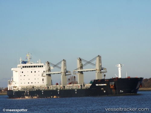
Vessel Red Diamond IMO: 9331713, MMSI: 636014524 Bulk Carrier
UTC, 26.65100, 122.85315, course: -1, speed: 8
UTC, 26.91630, 122.87254, course: 2, speed: 8.1
2026-02-26 22:47:10 UTC, 27.09728, 122.88641, course: -1, speed: 7.7
Live AIS position:
UTC. 93 nm SE of Wenling Longmen Port),
updated 2026-02-26 22:47:10 UTC.
Find the position of the vessel Red Diamond on the map. The latter are known coordinates and path.
marine traffic ship tracker show on live map
The current position of vessel Red Diamond is 27.09728 lat / 122.88641 lng. Updated: 2026-02-26 22:47:10 UTCCurrently sailing under the flag of Liberia
Red Diamond built in 2011 year
Deadweight:
53000 tDetails:
Last coordinates of the vessel:
UTC, 26.02829, 122.81690, course: 349, speed: 8UTC, 26.65100, 122.85315, course: -1, speed: 8
UTC, 26.91630, 122.87254, course: 2, speed: 8.1
2026-02-26 22:47:10 UTC, 27.09728, 122.88641, course: -1, speed: 7.7