 vesseltracker.com
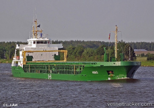
Vessel KEIT IMO: 9333450, MMSI: 305497000 General Cargo
UTC, 57.07097, 24.00616, course: 320, speed: 8.2
UTC, 57.18166, 23.77459, course: 310, speed: 7
2026-02-24 00:04:06 UTC, 57.43349, 23.19825, course: 320, speed: 8.6
Live AIS position:
UTC. Near MERSRAGS),
updated 2026-02-24 00:04:06 UTC.
Find the position of the vessel KEIT on the map. The latter are known coordinates and path.
marine traffic ship tracker show on live map
The current position of vessel KEIT is 57.43349 lat / 23.19825 lng. Updated: 2026-02-24 00:04:06 UTCCurrently sailing under the flag of Antigua and Barbuda
Details:
Last coordinates of the vessel:
UTC, 57.03402, 24.08293, course: 142, speed: 0UTC, 57.07097, 24.00616, course: 320, speed: 8.2
UTC, 57.18166, 23.77459, course: 310, speed: 7
2026-02-24 00:04:06 UTC, 57.43349, 23.19825, course: 320, speed: 8.6