 vesseltracker.com
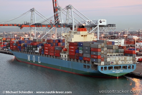
Vessel Mol Explorer IMO: 9333826, MMSI: 372827000 Container Ship
UTC, -20.69357, 58.05195, course: 239, speed: 18.4
UTC, -20.87167, 57.73500, course: -1, speed: 18
2026-02-08 22:11:47 UTC, -21.26667, 56.94833, course: -1, speed: 17
Live AIS position:
UTC. 53 nm SW of Bel Ombre),
updated 2026-02-08 22:11:47 UTC.
Find the position of the vessel Mol Explorer on the map. The latter are known coordinates and path.
marine traffic ship tracker show on live map
The current position of vessel Mol Explorer is -21.26667 lat / 56.94833 lng. Updated: 2026-02-08 22:11:47 UTCDetails:
Last coordinates of the vessel:
UTC, -20.27167, 58.73333, course: -1, speed: 18UTC, -20.69357, 58.05195, course: 239, speed: 18.4
UTC, -20.87167, 57.73500, course: -1, speed: 18
2026-02-08 22:11:47 UTC, -21.26667, 56.94833, course: -1, speed: 17