 vesseltracker.com
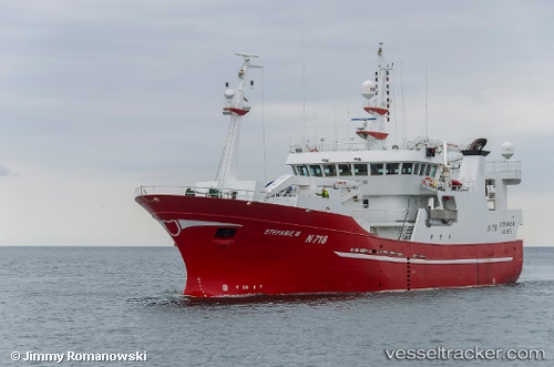
Vessel Stefanie M IMO: 9334337, MMSI: 235112317 Fish Carrier
UTC, 54.61017, -5.91391, course: -1, speed: 0
UTC, 54.61017, -5.91391, course: -1, speed: 0
2026-01-17 17:10:11 UTC, 54.61017, -5.91391, course: -1, speed: 0
Live AIS position:
UTC. Near Belfast),
updated 2026-01-17 17:10:11 UTC.
Find the position of the vessel Stefanie M on the map. The latter are known coordinates and path.
marine traffic ship tracker show on live map
The current position of vessel Stefanie M is 54.61017 lat / -5.91391 lng. Updated: 2026-01-17 17:10:11 UTCCurrently sailing under the flag of United Kingdom
Stefanie M built in 2005 year
Deadweight:
992 tDetails:
Last coordinates of the vessel:
UTC, 54.61017, -5.91391, course: -1, speed: 0UTC, 54.61017, -5.91391, course: -1, speed: 0
UTC, 54.61017, -5.91391, course: -1, speed: 0
2026-01-17 17:10:11 UTC, 54.61017, -5.91391, course: -1, speed: 0