 vesseltracker.com
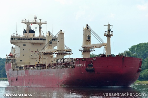
Vessel Umiak I IMO: 9334715, MMSI: 316013340 Bulk Carrier
UTC, 48.82216, -59.21639, course: 26, speed: 8.8
UTC, 49.06321, -59.02275, course: 25, speed: 8.5
2026-02-14 03:57:15 UTC, 49.31290, -58.81509, course: 29, speed: 9.4
Live AIS position:
UTC. 23 nm W of Mont-Saint-Gregoire),
updated 2026-02-14 03:57:15 UTC.
Find the position of the vessel Umiak I on the map. The latter are known coordinates and path.
marine traffic ship tracker show on live map
The current position of vessel Umiak I is 49.31290 lat / -58.81509 lng. Updated: 2026-02-14 03:57:15 UTCDetails:
Last coordinates of the vessel:
UTC, 48.57076, -59.41434, course: 5, speed: 8.1UTC, 48.82216, -59.21639, course: 26, speed: 8.8
UTC, 49.06321, -59.02275, course: 25, speed: 8.5
2026-02-14 03:57:15 UTC, 49.31290, -58.81509, course: 29, speed: 9.4