 vesseltracker.com
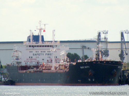
Vessel Blue Sky I IMO: 9335903, MMSI: 636016728 Chemical Oil Products Tanker
UTC, 1.23534, 103.81911, course: 111, speed: 0.1
UTC, 1.23548, 103.81928, course: 117, speed: 0.1
2026-02-07 19:22:22 UTC, 1.23393, 103.82187, course: 316, speed: 0.1
Live AIS position:
UTC. Near Singapore),
updated 2026-02-07 19:22:22 UTC.
Find the position of the vessel Blue Sky I on the map. The latter are known coordinates and path.
marine traffic ship tracker show on live map
The current position of vessel Blue Sky I is 1.23393 lat / 103.82187 lng. Updated: 2026-02-07 19:22:22 UTCCurrently sailing under the flag of Liberia
Blue Sky I built in 2006 year
Deadweight:
38402 tDetails:
Last coordinates of the vessel:
UTC, 1.23524, 103.81906, course: 103, speed: 0.1UTC, 1.23534, 103.81911, course: 111, speed: 0.1
UTC, 1.23548, 103.81928, course: 117, speed: 0.1
2026-02-07 19:22:22 UTC, 1.23393, 103.82187, course: 316, speed: 0.1