 vesseltracker.com
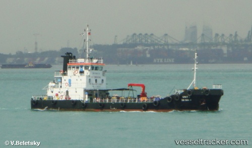
Vessel Unity IMO: 9337767, MMSI: 563158000 Service Ship
UTC, 1.23786, 103.80397, course: -1, speed: 0.1
UTC, 1.23806, 103.80431, course: -1, speed: 0.3
2026-02-14 07:33:31 UTC, 1.22799, 103.80138, course: -1, speed: 5.4
Live AIS position:
UTC. Near Pasir Panjang Wharves),
updated 2026-02-14 07:33:31 UTC.
Find the position of the vessel Unity on the map. The latter are known coordinates and path.
marine traffic ship tracker show on live map
The current position of vessel Unity is 1.22799 lat / 103.80138 lng. Updated: 2026-02-14 07:33:31 UTCCurrently sailing under the flag of Singapore
Unity built in 2005 year
Deadweight:
599 tDetails:
Last coordinates of the vessel:
UTC, 1.23007, 103.87367, course: -1, speed: 5.2UTC, 1.23786, 103.80397, course: -1, speed: 0.1
UTC, 1.23806, 103.80431, course: -1, speed: 0.3
2026-02-14 07:33:31 UTC, 1.22799, 103.80138, course: -1, speed: 5.4